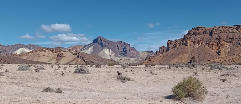
En la comarca Andino Patagónica, específicamente en la provincia de Chubut, Argentina, muy cerca del pueblo de Gualjaina existe una zona de no fácil acceso, maravillosa para la vista y el resto de los sentidos, es una antiquísima formación geológica, un enorme volcán extinto hace millones de años al que se dio por nombre La Caldera.

Decía que no es de fácil acceso pues se llega por caminos rurales, secundarios y rutas provinciales, todas ellas de tierra y piedra, es casi imprescindible contar con los servicios de un guía y un vehículo especial con tracción integral para disfrutar de todo lo que tiene para ofrecernos.
Toda esta área corresponde a formaciones geológicas del Mioceno lo que sitúa a la Caldera entre unos 5 y 23 millones de años de antigüedad, aunque nuestro guía, el único certificado en todo Gualjaina, mencionó 60 millones de años; es algo que quedó para preguntarle la próxima vez que acuda a esa zona, algo que sucede con cierta frecuencia ya que hay por allí unos buenos lugares de pesca y yo soy un entusiasta del flyfishing, si a ello le sumo que mi hijo y su familia viven a tan solo unos 100 kilómetros de ese lugar, seguramente estaré pronto visitando la región una vez más.
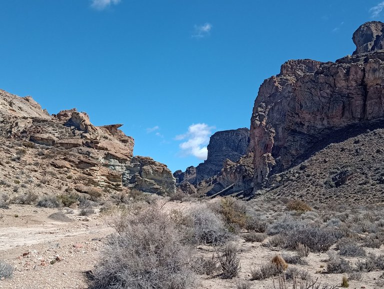
El término con que se denomina a toda esta enorme región se refiere a la gran depresión formada cuando el magma fue derramado provocando el colapso de la cima del volcán, en este caso, el mismo era de tales dimensiones, que salvo desde el aire, no se llegan a divisar los bordes del cuello volcánico. Para tranquilidad de todos, está extinto por lo que toda actividad cesó millones de años atrás.

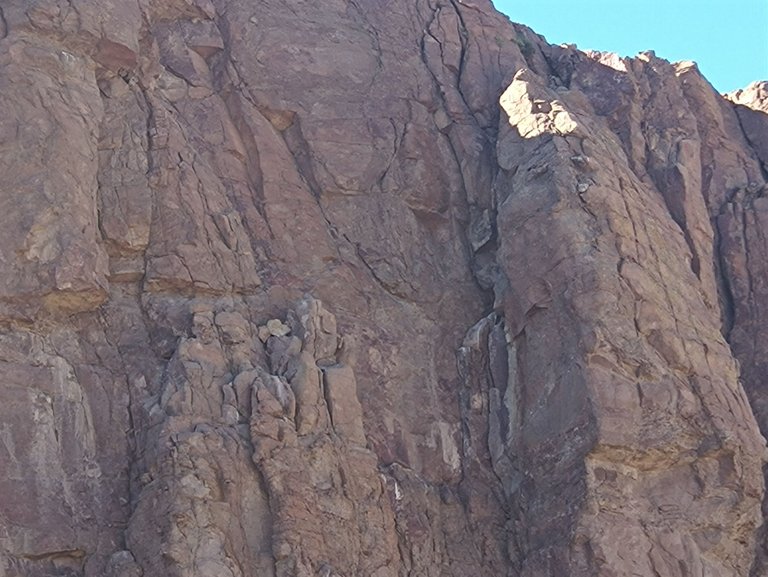
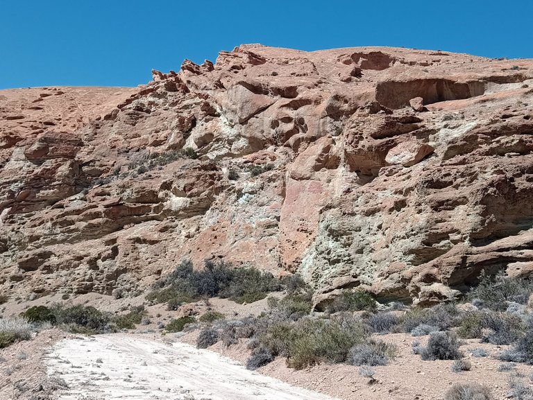
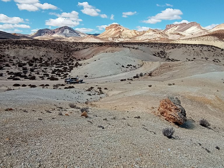
Apenas comenzado el paseo el relato del guía nos explica lo que vemos, al ser neófitos en temas geológicos, es imposible comprender lo que se ve, son formaciones rocosas y los datos abruman en parte: riolitas, basaltos, andesitas, diferentes tipos de rocas que corresponden a períodos caóticos, justamente cuando se formaron las cadenas montañosas de Los Andes en América del Sur y las cordilleras Béticas y del Rif en Europa. La única forma de preservar los datos es mediante la grabación de las explicaciones, por suerte se nos ocurrió hacerlo y hoy puedo trasmitir algunos pocos conceptos, inclusive nada académicos pero voluntariosos sobre la experiencia vivida.
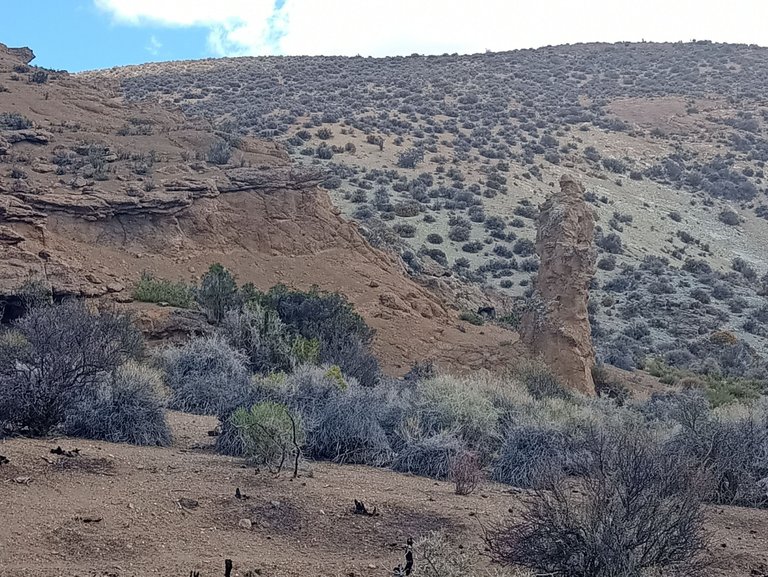
Observamos un paisaje que puedo imaginar como lunar, aunque Jorge, el guía, rápidamente nos pone en contexto: la mayoría de las diversas estructuras visibles son conos volcánicos erosionados, domos de lava y depósitos piroclásticos. La erosión eólica, fluvial y gravitacional moldearon lo que ahora se ve, surgieron a la vista formaciones de rocas más duras y se plegaron y desaparecieron de la vista otras de material más blando. Vemos ahora las capas internas más escondidas del antiguo volcán.
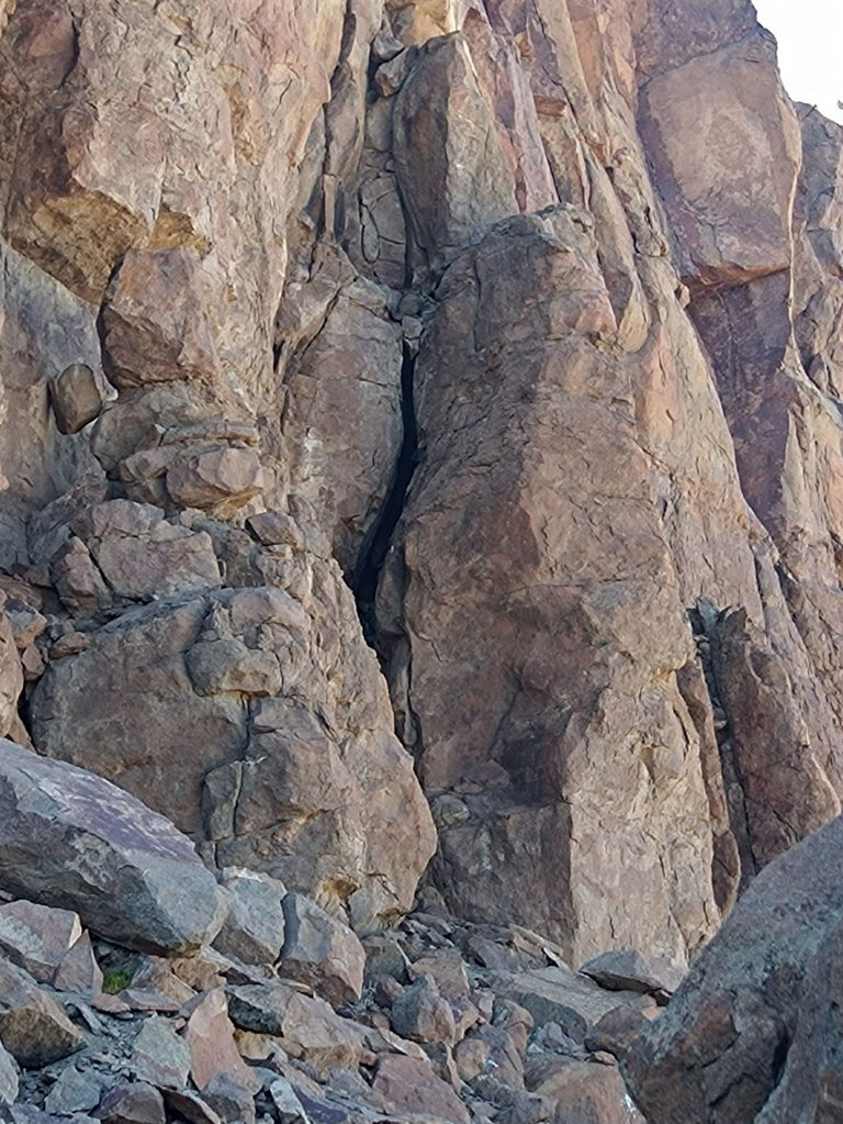
Apreciamos domos de rocas vitrificadas, donde por más empinada que fuera una cuesta no afecta el equilibrio, no hay posibilidad de patinar, las zapatillas se aferran al suelo como si tuvieran ventosas, hay que tener cuidado, es vidrio literalmente y rasparse la piel puede provocar lesiones.

chinchillones
En otro sector nos maravillamos de enormes formaciones de rocas que se erigen rectas, algo así como acantilados, es el lugar de residencia ideal para el chinchillón, un simpático animalito parecido a la vizcacha aunque reservado y tímido, gusta de esos lugares escarpados y altos, difíciles de observar debido a su pelaje que se asemeja al de las rocas donde habita, pero alguna fotografía hay, quizás no tan nítida como deberían, lo siento.
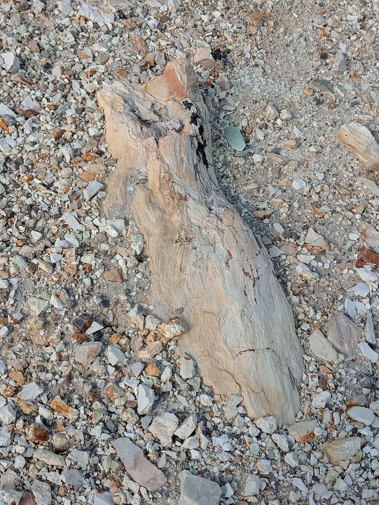

árboles petrificados
En algún momento del paseo nos acercamos a una zona de árboles petrificados, lamentablemente no es un área protegida y según Jorge muchos desaprensivos visitantes se llevan trozos como recuerdo.
Guardián del averno
La erosión moldea las rocas, el juego de imaginar personas, animales y objetos se hace presente y rememora otro lugar mucho más famoso al que se denomina Valle Encantado, camino a la turística ciudad de Bariloche, al igual que allí vemos formaciones caprichosas donde no dudamos en bautizar cada una de acuerdo a lo que nuestra vista e imaginación así lo indican: calaveras de alienígenas, el guardián del ingreso al averno, el lobo marino y la cabeza de oso, el templario y muchas otras formas a las que dimos nombres que ya olvidamos.
Templario
Calaveras de alienígenas

Lobo marino y cabeza de oso
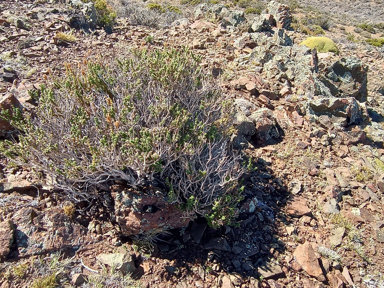
El relieve actual no se parece en nada al del período en que el enorme volcán estaba activo, ahora tenemos áreas bien definidas entre mesetas elevadas, cañadones, desfiladeros y cerros bajos y redondeados, la vegetación es típica de la estepa patagónica, encontramos yaretas, un arbusto redondeado que se puede confundir con musgo adherido a rocas, coirones que son plantas finas y alargadas similares a la paja, otros arbustos cuyo nombre no recuerdo pero de características similares: bajos y adaptados al clima árido y seco que predomina en la región.
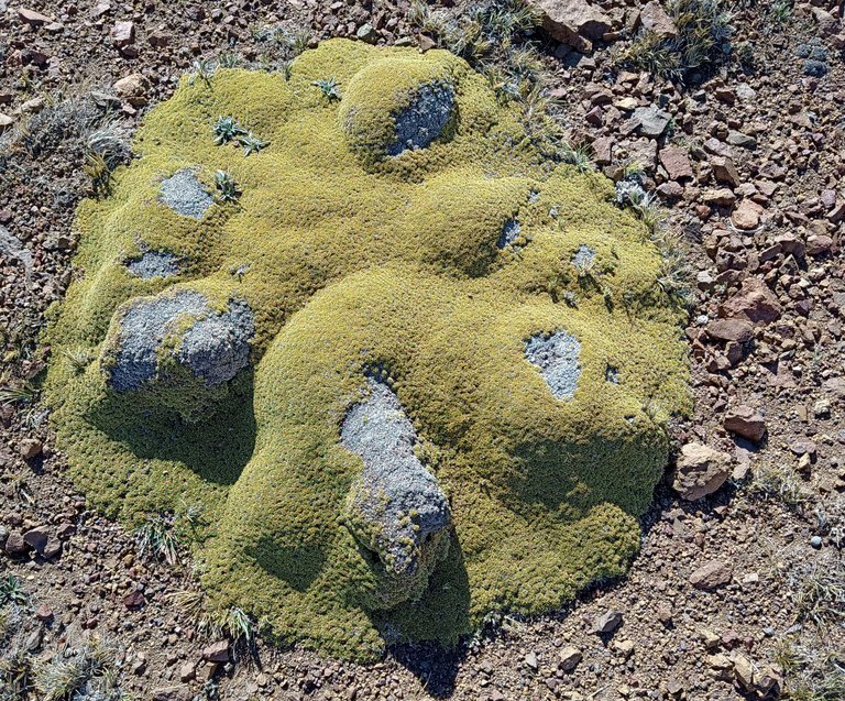
Yaretas
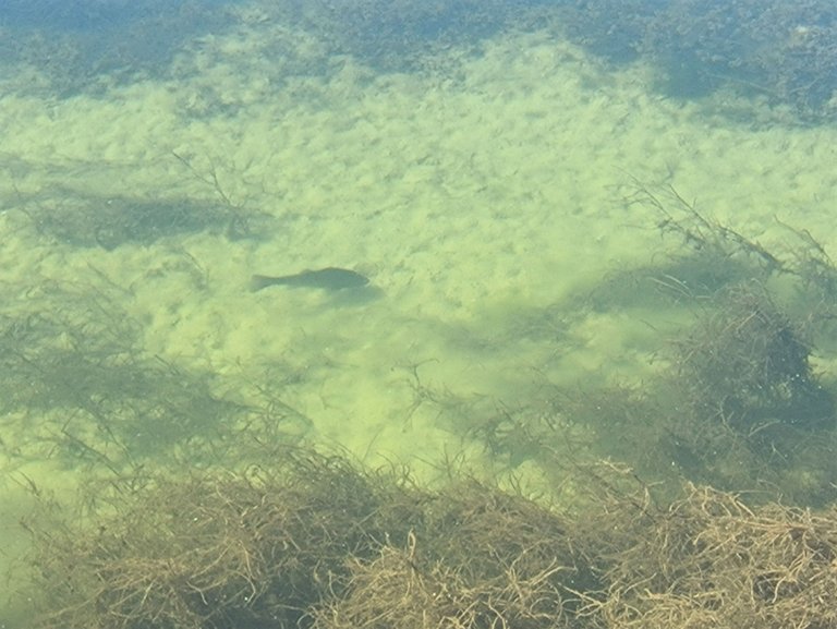
También tenemos algunos pocos arroyos y vertientes que generalmente se secan en época estival, aunque hay un par de ríos, la cuenca del Río Gualjaina y su confluencia con el Chubut, lugar donde abundan las grandes truchas.
Para el final del paseo nos esperan más sorpresas, en primer lugar, el Cañadón de la Buitrera, un desfiladero de aproximadamente 3 Km. de longitud con altos paredones que pueden llegar a medir 100 metros, además de conservar algunas pinturas rupestres de las culturas indígenas Mapuche y Tehuelche, es una zona ideal para la práctica de escalada en roca y el descenso en rapel, también el senderismo, la observación de fauna y la fotografía son actividades ideales.
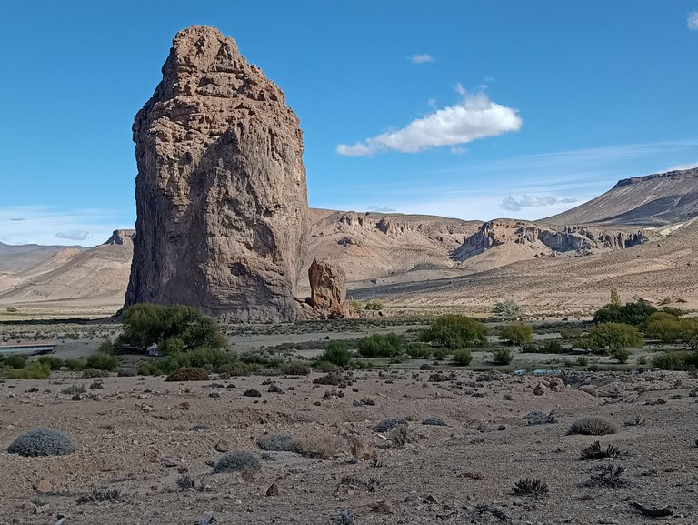
Piedra Parada
Todo culmina en la Piedra Parada, una gigantesca mole de piedra, principalmente riolita aunque también posee restos de otras rocas ígneas, tiene 240 metros de altura con un diámetro de 100 metros, según el guía, es un remanente solidificado de la chimenea volcánica.
El paraíso de la geología diría alguno, aunque nosotros sin formar parte de ese segmento de la ciencia, igualmente disfrutamos de cosas más sencillas como los paisajes, la flora y fauna y las distintas formaciones de piedra.
Casi 6 horas de travesía que se fueron rapidísimo, el tiempo no es una variable significativa cuando la magnificencia de la naturaleza ocupa todos nuestros sentidos.
The boiler
In the Andean Patagonian region, specifically in the province of Chubut, Argentina, near the town of Gualjaina, there is an area that is difficult to access but marvelous for the eyes and the other senses. It is an ancient geological formation, a huge volcano that became extinct millions of years ago and was named La Caldera.
I mentioned that it is not easily accessible, as it is accessed via rural, secondary, and provincial roads, all of which are made of dirt and stone. It is almost essential to have the services of a guide and a special all-wheel-drive vehicle to enjoy everything it has to offer.
This entire area corresponds to Miocene geological formations, which places the Caldera between 5 and 23 million years old, although our guide, the only certified one in all of Gualjaina, mentioned 60 million years; it's something I'll ask him about the next time I'm in the area, something that happens quite frequently, since there are some good fishing spots there and I'm a flyfishing enthusiast. Add to that the fact that my son and his family live just 100 kilometers away, and I'll surely be visiting the region again soon.
The term used to describe this entire vast region refers to the large depression formed when magma spilled out, causing the collapse of the volcano's summit. In this case, the volcano was so large that the edges of the volcanic neck are invisible except from the air. For everyone's peace of mind, it's extinct, so all activity ceased millions of years ago.
Barely beginning the walk, the guide's narrative explains what we're seeing. Being geological novices, it's impossible to understand what we're seeing. These are rock formations, and the information is somewhat overwhelming: rhyolites, basalts, andesites, different types of rocks that correspond to chaotic periods, precisely when the Andes mountain ranges in South America and the Betic and Rif mountain ranges in Europe were formed. The only way to preserve the information is by recording the explanations. Luckily, we thought of doing so, and today I can convey a few concepts, even non-academic but purposeful, about the experience.
We observe a landscape that I imagine to be lunar, although Jorge, the guide, quickly puts us in context: most of the various visible structures are eroded volcanic cones, lava domes, and pyroclastic deposits. Wind, river, and gravitational erosion shaped what we see now. Harder rock formations emerged, and softer ones folded and disappeared. We now see the more hidden inner layers of the ancient volcano.
We see domes of vitrified rocks, where no matter how steep the slope, it doesn't affect balance. There's no chance of slipping. Shoes grip the ground as if they had suction cups. You have to be careful; it's glass, and scraping your skin can cause injury.
In another area, we see enormous rock formations that rise straight, somewhat like cliffs. This is the ideal habitat for the chinchillón, a friendly little animal similar to the vizcacha, although reserved and shy. It likes these steep, high places, difficult to observe due to its fur, which resembles that of the rocks it inhabits. However, there are some photographs, perhaps not as clear as they should be.
At some point during the walk, we approached an area of petrified trees. Unfortunately, it's not a protected area, and according to Jorge, many unscrupulous visitors take pieces as souvenirs.
Erosion shapes the rocks, and the game of imagining people, animals, and objects takes over, recalling another, much more famous place called the Enchanted Valley, on the way to the tourist city of Bariloche. There, we see whimsical formations, each of which we quickly name according to what our vision and imagination suggest: alien skulls, the guardian of the entrance to the underworld, the sea lion and the bear's head, the Templar, and many other forms we've given names we've since forgotten.
The current relief bears no resemblance to that of the period when the enormous volcano was active. Now we have well-defined areas between elevated plateaus, canyons, gorges, and low, rounded hills. The vegetation is typical of the Patagonian steppe. We find yaretas, a rounded shrub that can be confused with moss attached to rocks; coirones, thin, elongated plants similar to straw; and other shrubs whose names I don't recall but with similar characteristics: low and adapted to the arid, dry climate that prevails in the region.
We also have a few streams and springs that generally dry up in the summer, although there are a couple of rivers, the Gualjaina River basin and its confluence with the Chubut River, where large trout are abundant.
More surprises await us at the end of the tour. First, the Cañadón de la Buitrera, a gorge approximately 3 km long with high walls that can reach 100 meters. In addition to preserving some cave paintings from the Mapuche and Tehuelche indigenous cultures, it is an ideal area for rock climbing and rappelling. Hiking, wildlife watching, and photography are also ideal activities.
It all culminates at Piedra Parada, a gigantic mass of stone, primarily rhyolite, although it also contains remains of other igneous rocks. It is 240 meters high with a diameter of 100 meters. According to the guide, it is a solidified remnant of a volcanic vent.
Some might say it's a geological paradise, although we, without being part of that segment of science, also enjoyed simpler things like the landscapes, the flora and fauna, and the various rock formations.
Almost 6 hours of travel that went by very quickly; time is not a significant variable when the magnificence of nature occupies all our senses.
Héctor Gugliermo
@hosgug
You can check out this post and your own profile on the map. Be part of the Worldmappin Community and join our Discord Channel to get in touch with other travelers, ask questions or just be updated on our latest features.
Thank you! @worldmappin
Hey @hosgug you are welcome.
Thanks for using @worldmappin 😘
Patagonia has been one of the places I have to visit for a long time.
Your post has made me want to go even more.
Congratulations on the photographs and information about this inhospitable place.
Thank you very much. There are many foreign visitors to the Buitrera Canyon and Piedra Parada who enjoy adventure tourism, climbing, and rappelling.
Greetings @cryptoreforma, and thanks again for stopping by my post.
Hiya, @lauramica here, just swinging by to let you know that this post made it into our Top 3 in Travel Digest #2581.
Your post has been manually curated by the @worldmappin team. If you like what we're doing, please drop by to check out all the rest of today's great posts and consider supporting other authors like yourself and us so we can keep the project going!
Become part of our travel community:
Thank you @lauramica!!
You are very welcome @hosgug! it was well deserved. ☀️
Keep up the great work 💪
Excellent work @hosgug, very good that you used the recording tool to transmit us all the new knowledge you acquired. I loved your visit. Many congratulations!
Thank you very much @anicruzmh, when it comes to a topic that exceeds my knowledge and the information is abundant with names and technical terms, this is the best thing you can do to remember and learn.
Nice share! Beautiful place
!LOLZ
lolztoken.com
I told him that's the last thing I need.
Credit: reddit
@hosgug, I sent you an $LOLZ on behalf of vaynard.fun
(10/10)
Farm LOLZ tokens when you Delegate Hive or Hive Tokens.
Click to delegate: 10 - 20 - 50 - 100 HP
Thank you @vaynard.fun!