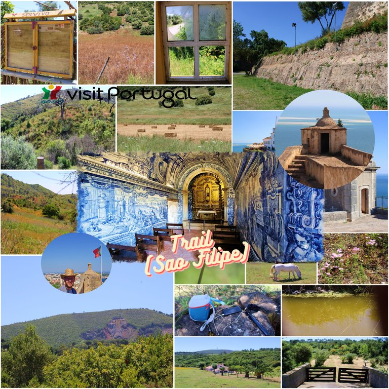
Good morning, adventurous friends! For hundreds of years, Portugal and its neighbor Spain, in a race of conquests, adapted their warlike pursuit to the construction of fortresses and castles to preserve their lands and defend against future invasions. Setubal is a very important coastal city in the country! It had already been occupied since prehistoric times. My post today is to follow a set of trails (GR11 E9; PR4 PLM) until reaching a famous military fort called: (São Filipe). Enjoy my experience.🏰👩🏻🏫🌍
¡Buenos días, amigos aventureros! Desde cientos de años, Portugal y su vecino España en una carrera de conquistas adaptaron su corrida bélica a la construcción de fortalezas y castillos para poder preservar sus tierras y defenderse a futuras invasiones, Setubal es una ciudad costera muy importante en el país! Ya había sido ocupada desde la prehistoria, mi post de hoy es realizar un conjunto de Senderos (GR11 E9 ; PR4 PLM) hasta llegar a un famoso Fuerte militar llamado: (São Filipe), disfruta mi experiencia.🚙🗺️🏕️
¿Where are we now?🌍🚩/ ¿Donde estamos ahora?🗺️🏰
 coordinates 38.566927, -8.903845/ Coordenadas 38.566927, -8.903845
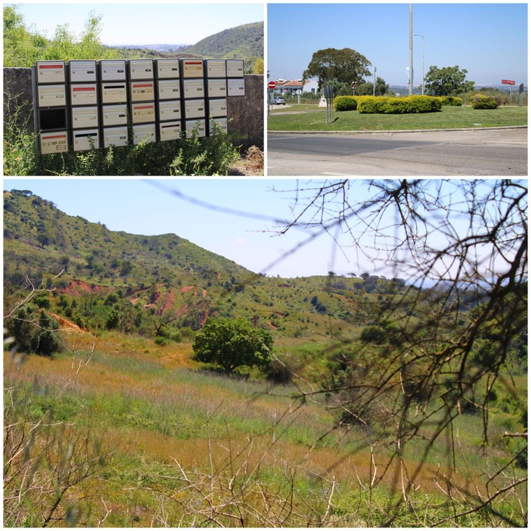
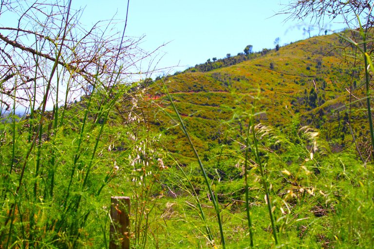
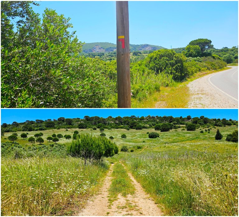
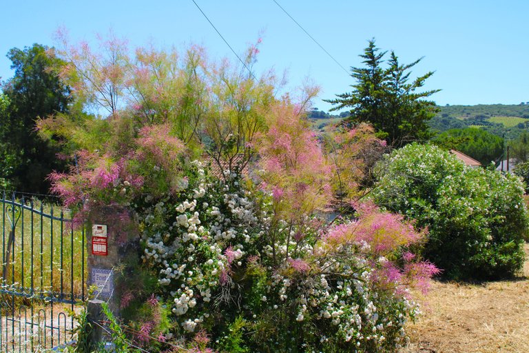
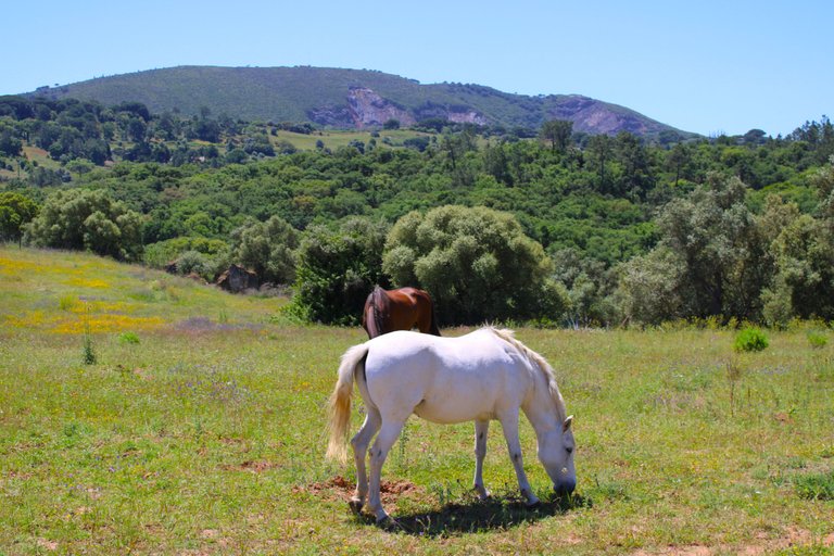
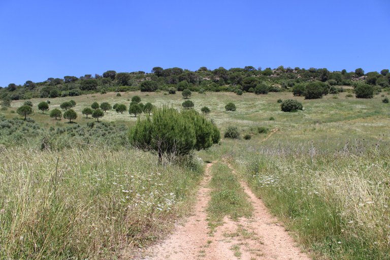
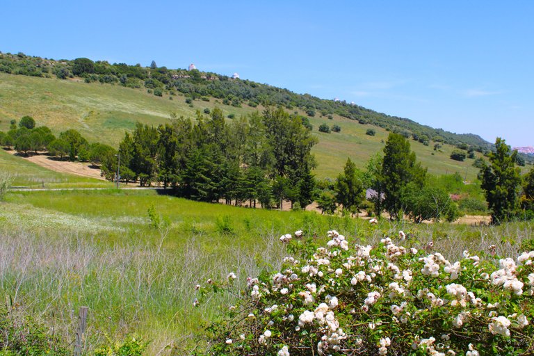
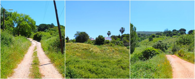
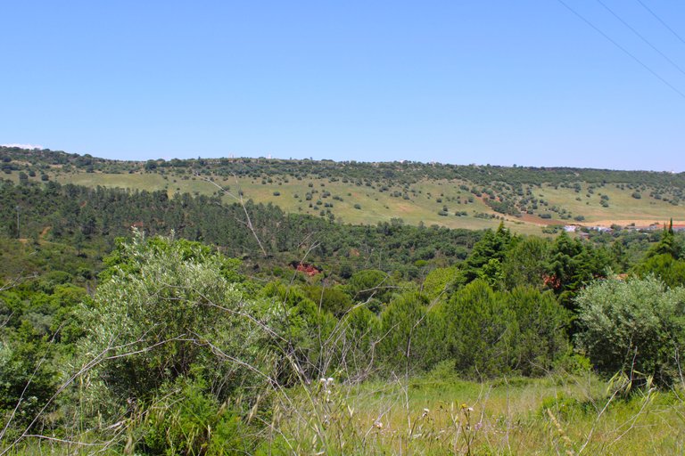
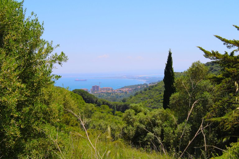
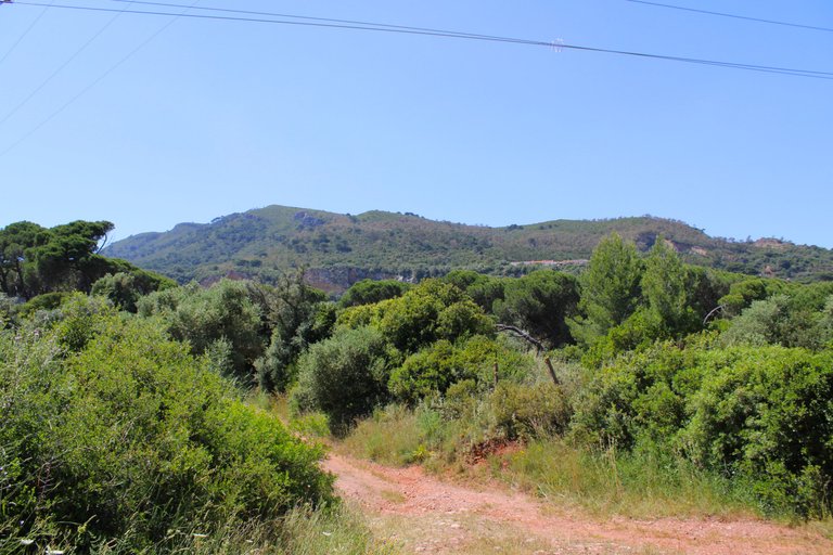
The walk of this adventure starts from the street: (estrada de barris) in front of the square: (Jardim de alameda) to be even more exact I leave you the coordinates: (38.569965, -8.907045) what we will do is follow this road until we find the sign (PR4 PLM), we can't get lost, it's always in front of us, from now on we have a beautiful view of the Arrabida valley followed by the Palmela castle, at this stage of the walk it is not possible to see the São Filipe fort.🏕️🗺️
La caminata de esta aventura comienza a partir de la calle: (estrada de barris) en frente de la plaza: (Jardim de alameda) para ser aún más exacto les dejo las coordenadas: (38.569965, -8.907045) lo que haremos es seguir esta carretera hasta conseguirnos con el letrero (PR4 PLM), no tenemos perdida, es siempre en frente, desde ya tenemos una hermosa vista del valle de la Arrabida seguido del castillo de Palmela, en esta fase de la caminata no es posible ver el fuerte de São Filipe.🌍🏔️

Tips and route🌍🚩/ Consejos y recorrido🗺️🏰

Here's a gif of the route I took today on the hike, which totaled almost 21km! This made the trail quite long, lasting almost 4 hours. In my opinion, the best time of year to do it is spring when it's cooler. Summer isn't recommended for everyone, as you can experience a body temperature of over 40 degrees. It's essential to follow this trail with the following tips:👩🏻🏫🧭
¡Aquí te dejo un gif del recorrido que hice el día de hoy en la caminata, fue en total casi 21 km! Lo que hizo que el sendero fuera extenso con una duración de casi 4 horas, en mi opinión la mejor epoca del año para hacerlo es en primavera cuando está más fresco, el verano no es recomendado para cualquier persona, puedes vivenciar una temperatura corporal de más de 40 grados, es indispensable hacer este sendero con los siguientes consejos:🗺️🌍
- Minimum 2 liters of water 🫗
- cool clothes and a hat🕶️🩳👕
- sunscreen and hiking poles 📍
- hiking boots and snacks 🧁🍪🍣
Start of the walk🌍🚩/ Comienzo de la caminata🗺️🏰
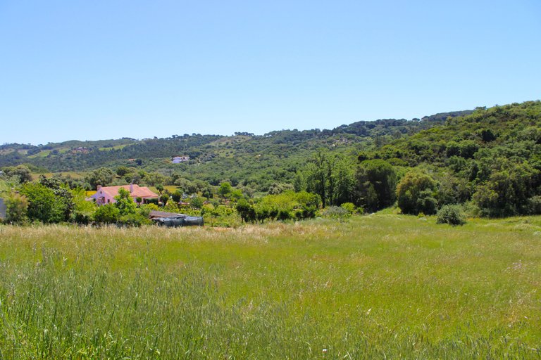
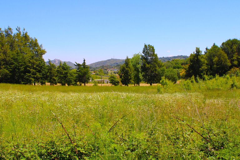
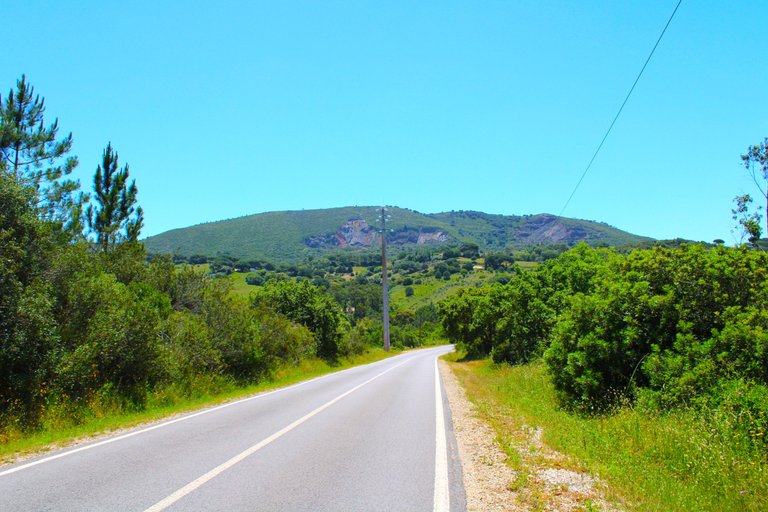
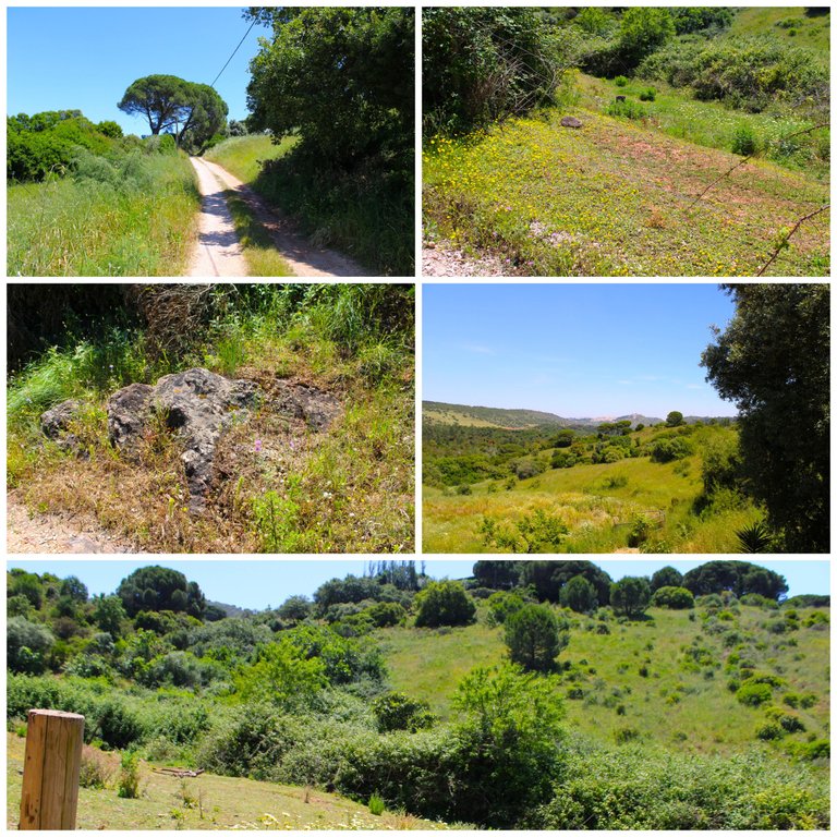
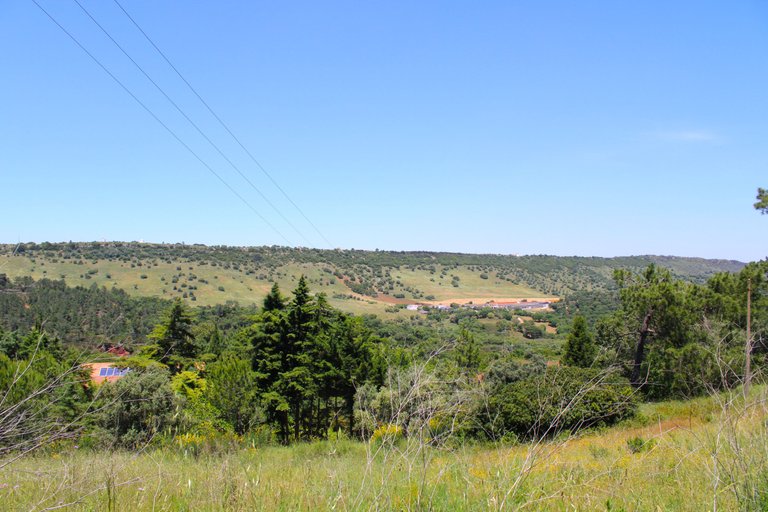
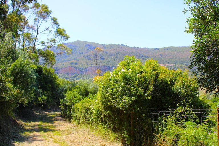
The walk is relaxing, today it was 28 degrees I thought it would be hotter, but the weather was nice the trail shows us two different faces when we are on the road we are in the valley between mountains and there is no wind at all, now when we climb the mountain range the weather does change and is cooler, I suppose it is the Atlantic breeze that comes here, this is less than 10 km from the coast.📍🌍
La caminata es relajante, hoy estaban 28 grados pensé que haría más calor, pero el clima estaba agradable el sendero nos muestra dos caras diferentes cuando estamos en la carretera estamos en el valle entre montañas y no hace nada de viento, ahora cuando subimos la sierra el clima si cambia y es más fresco, supongo que es la brisa del atlántico que viene hasta aquí, esto a menos de 10 km de la costa.🧭🗺️
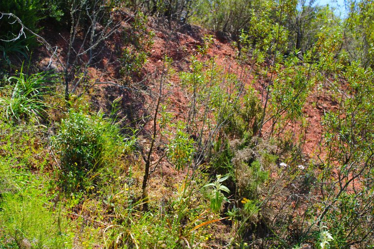
What do we learn from the ecosystem?🌍🚩/ ¿Que aprendemos del ecosistema?🗺️🏰
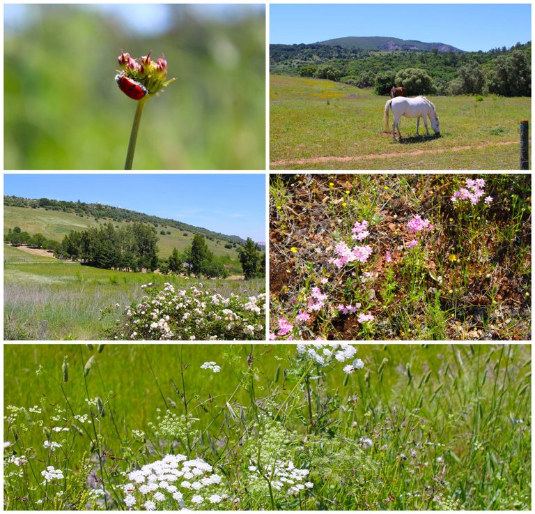
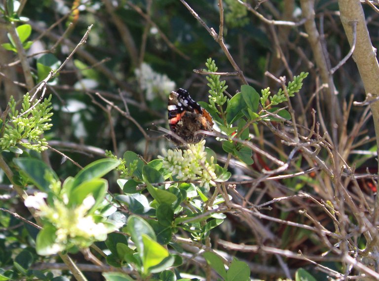
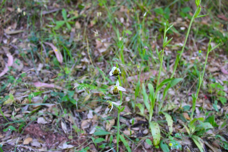
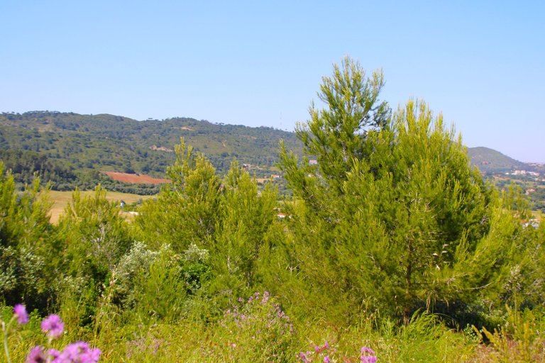
A brief summary of the nature and ecosystem we're in! This area is protected and belongs to the Arrabida region. We've already written many posts about it, so I don't want to dwell too much on it here. It's over 20 km long, making it one of the largest areas in Portugal, and it's on the Atlantic coast. This reserve is so important because I once mentioned that most of the wild orchids that make up our biodiversity are found in this area. It's common to see wild boars, foxes, and porcupines.📍🌍
Un pequeño resumen sobre la naturaleza y el ecosistema donde estamos! Esta zona es protegida y pertenece a la Arrabida, ya hicimos muchos post sobre ella por ello no quiero detenerme mucho aquí, tiene más de 20 km de extensión, siendo una de las zonas más extensas de Portugal y está en el litoral atlántico, esta reserva es tan importante porque una vez mencionaba que la mayor parte de orquídeas silvestre que dispone nuestra biodiversidad se encuentra en esta zona, es común ver jabalís, zorros, puercoespín.🧭🗺️
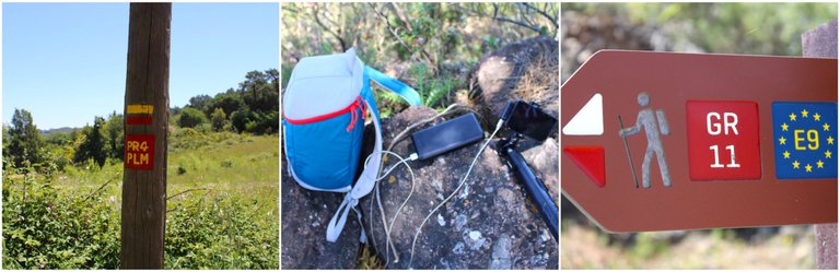
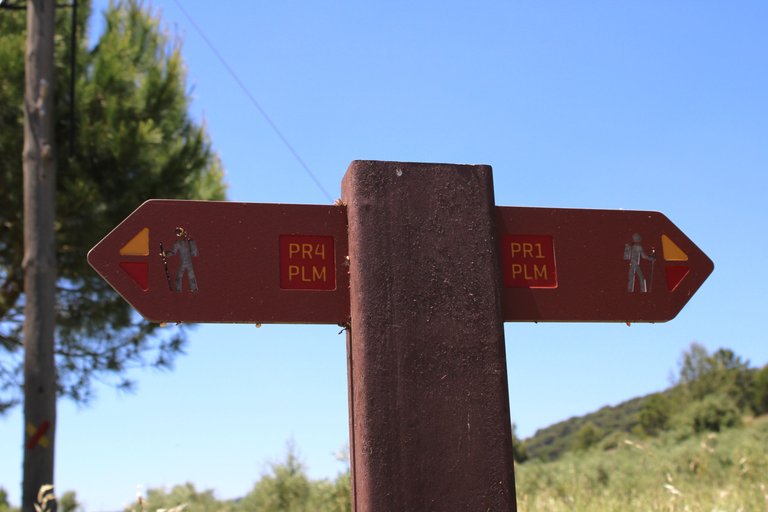
Something about the trails?🌍🚩/ ¿Algo sobre los senderos?🗺️🏰
The first trail we will take is the PR4 PLM, which consists of a 12.2 km circular walk and which in turn connects with the GR11 E9. This is a European trail that is thousands of kilometers long, so we conclude that to reach the military fort from the Palmela square we must complete both trails.🧭🌍
El primer sendero que nosotros realizaremos es el PR4 PLM que consiste en una caminata circular de 12.2 km y que a su vez se conecta con el GR11 E9 este es un sendero europeo que tiene miles de kilómetros por lo que concluimos que para llegar al fuerte militar desde la plaza de Palmela debemos completar ambos senderos.📍🗺️


Casuarinas Farm📍🌍
You'll love spending a few days in the area on vacation. You can hike many trails and enjoy nature, or go on bike rides. There are also hotels and rural farms where you can stay at very affordable prices. From here, you're just a few kilometers from the beach and less than 30 kilometers from Lisbon.🌍👩🏻🏫
Del área te gustará pasarte unos días de vacaciones, podrás completar muchos senderos y disfrutar de la naturaleza, o paseos en bicicleta, además de disponer de hoteles y granjas rurales que te permiten hospedarte por precios muy accesibles, de aquí estas a pocos km de la playa y menos de 30 km de Lisboa.🗺️🚩


A Pause🌍🌺/ Una Pausa🗺️📍
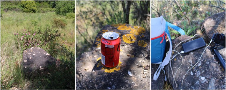
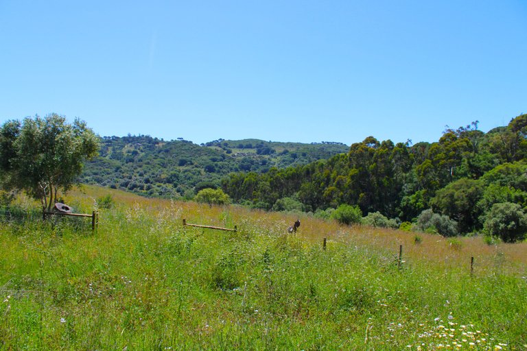
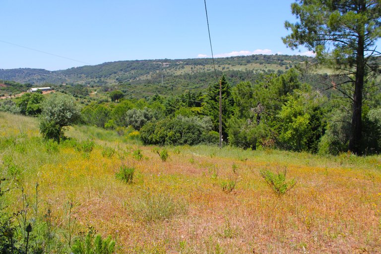
We had to make a quick 10-minute stop to cool off and eat a few things. As I mentioned, the sun was very strong, and I had to take frequent breaks to avoid heatstroke. I was reading that temperatures would rise to 36 degrees Celsius for the week of May 29th. Imagine that? This is already a warning that we can't do these hikes with small children.🗺️🌍🧭
Nos tocó hacer una pequeña parada de 10 minutos para refrescarnos y comer algunas cosas, como les comentaba, el sol estaba muy fuerte y tengo que hacer pausas continuas para evitar insolación, estaba leyendo que para la semana del 29/05 las temperaturas subirían a 36 imaginan eso? Esto es ya una advertencia que no podemos hacer estas caminatas con niños pequeños.🚩🏰

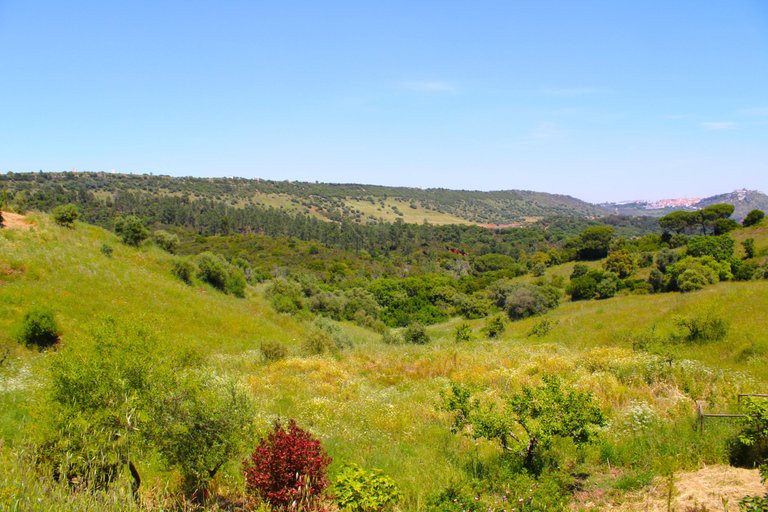

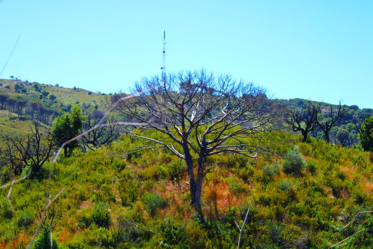
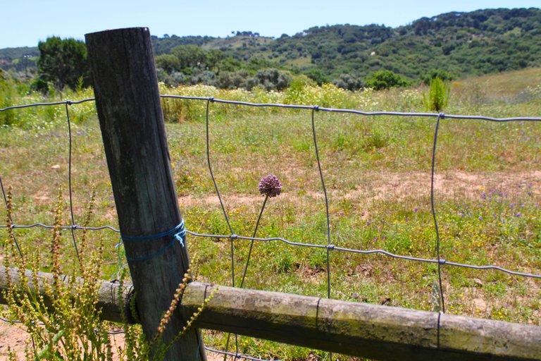
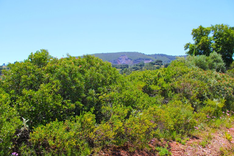
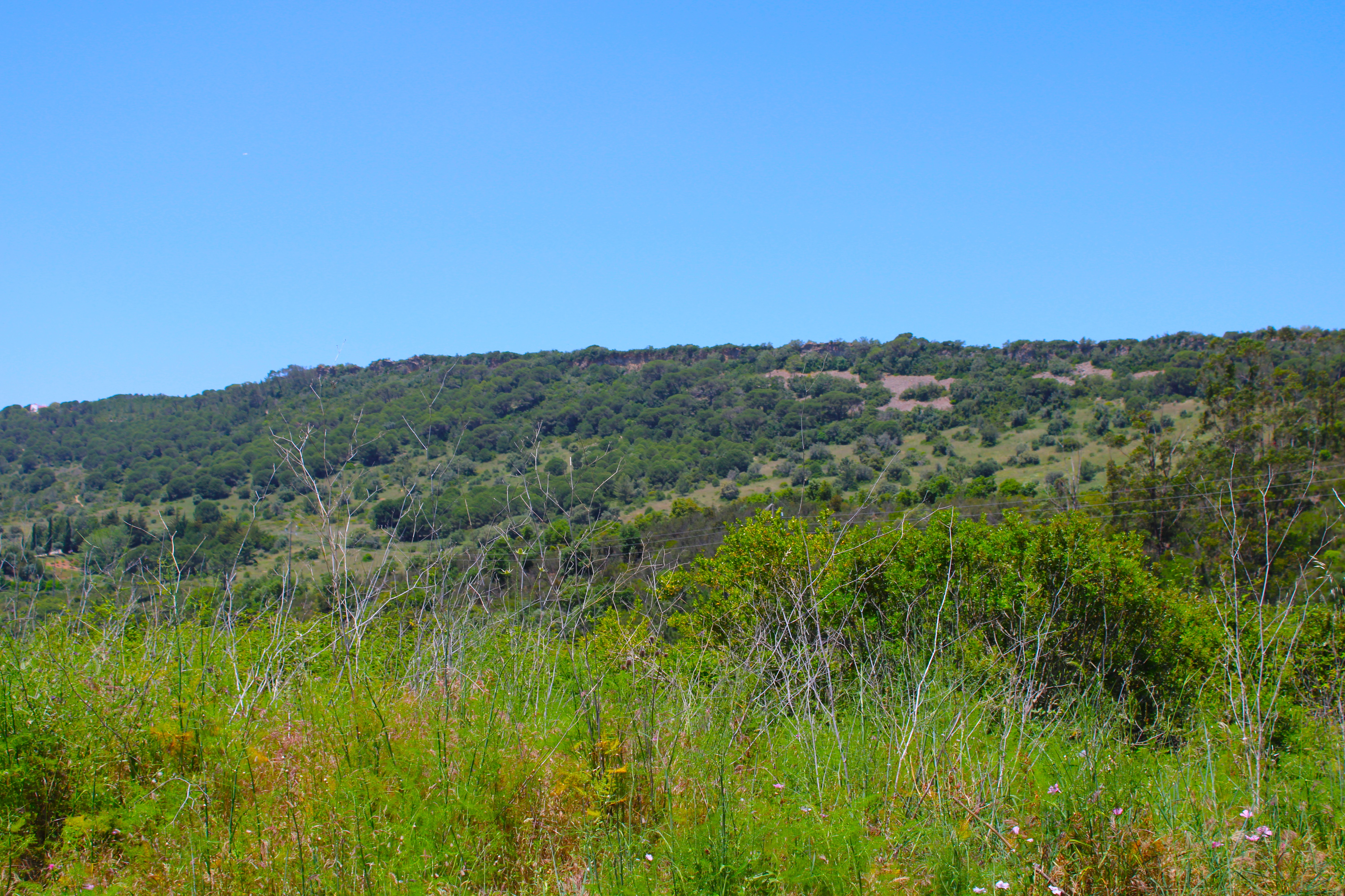
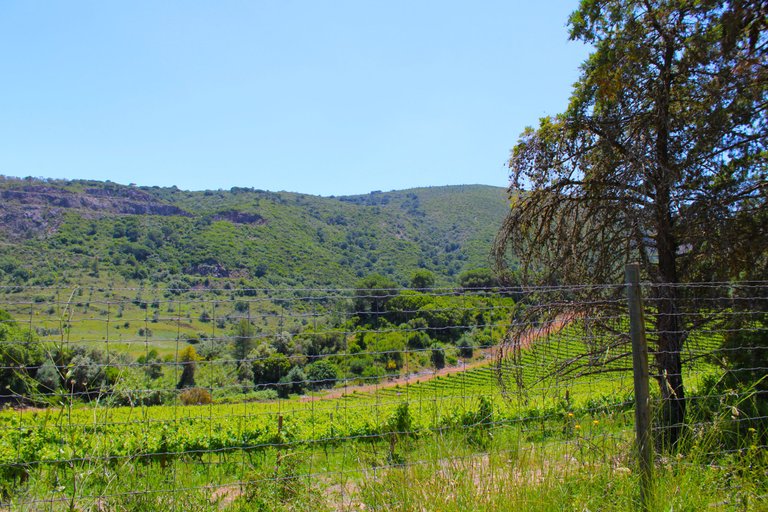
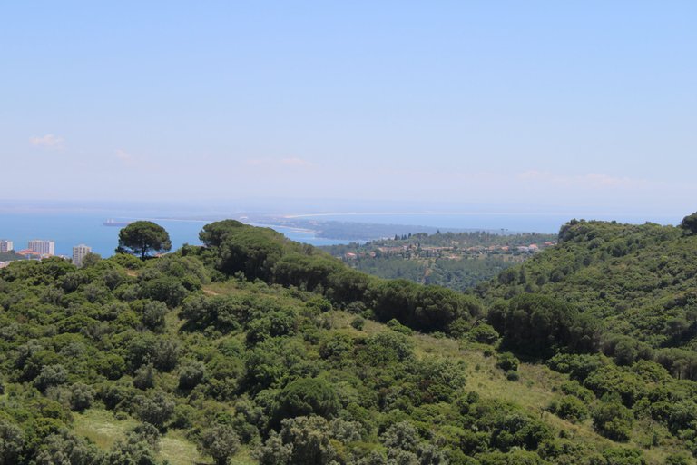
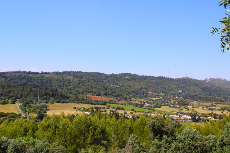
"Gaitero" Mountain Range🌍🏔️/ Sierra "do gaitero"🗺️📍

We are in one of the most beautiful and sought-after mountain ranges for hiking enthusiasts. From here we have other views of the city of Palmela, its highest point being 226 meters.📍🚩
Estamos en una de las sierras más bonitas y más buscadas por los amantes del Senderismo, desde aquí tenemos otras vistas hacia la ciudad de Palmela, siendo su punto más alto 226 metros.🗺️🏔️
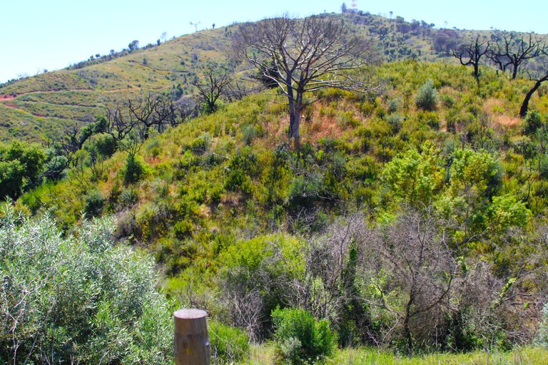
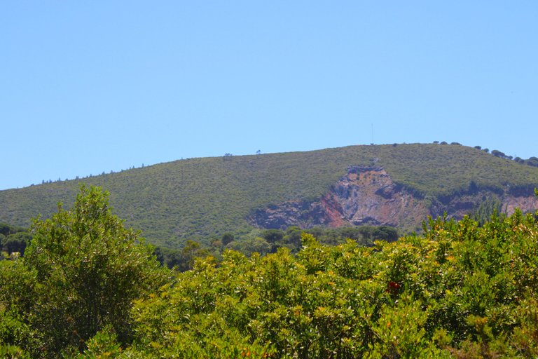
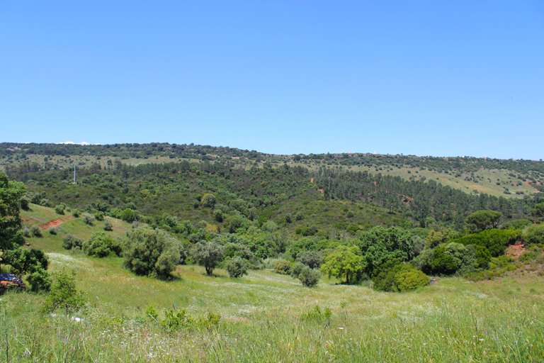
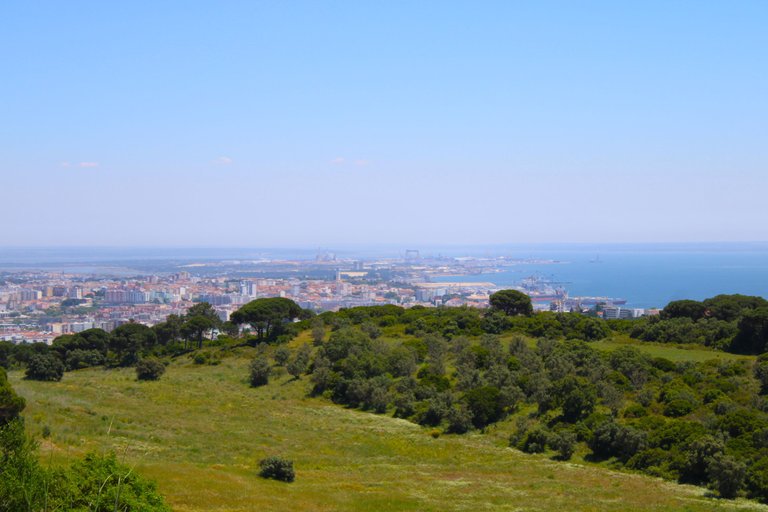
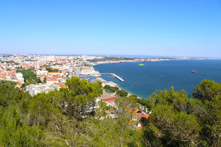
We already see the ocean🌍🏔️/ Ya vemos el oceano🗺️📍
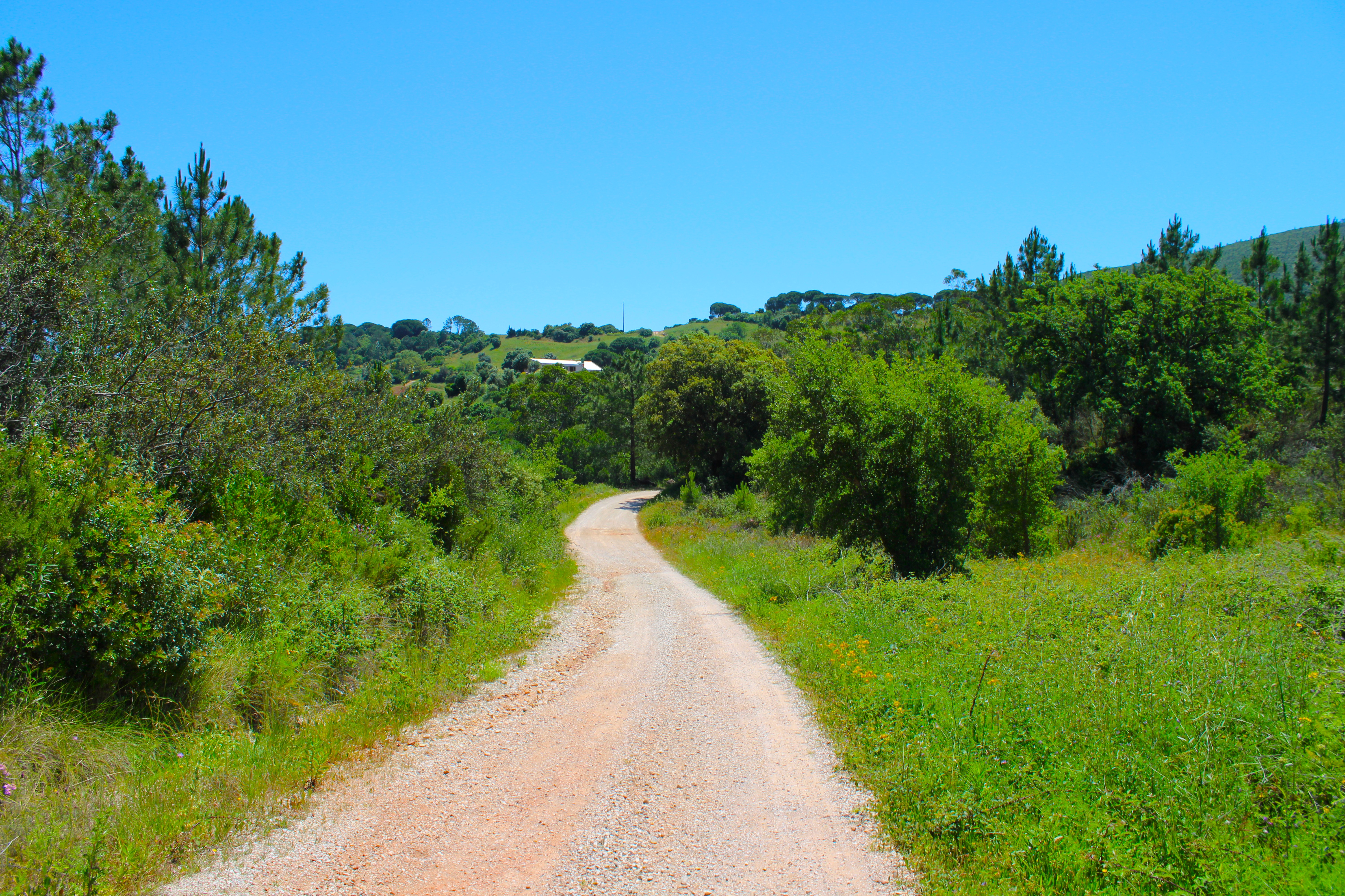
descent to the village of grelhal🗺️🏕️
When we see the ocean, we're at the highest point of the mountain range. Now we're going to change the trail and here we're going from the PR4 PLM to the GR11 E9. You'll get here easily, clearly, if you've followed my directions well! Now we're going to go down towards the national road N10 and then turn off to a town called Grelhal. There we'll climb another mountain range, which is where the fort is located.🌍👩🏻🏫
¡Cuando vemos el océano estamos en el punto más alto de la sierra, y ahora vamos a realizar un cambio en el sendero y aquí pasamos del PR4 PLM al GR11 E9, vas a llegar aquí fácilmente claramente si has seguido bien mis indicaciones! ahora vamos a bajar hacia la carretera nacional N10 y luego desviarnos a un pueblo llamado Grelhal ahi subiremos de nuevo otra sierra que es donde se ubica el fuerte.🗺️🚩
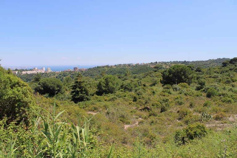
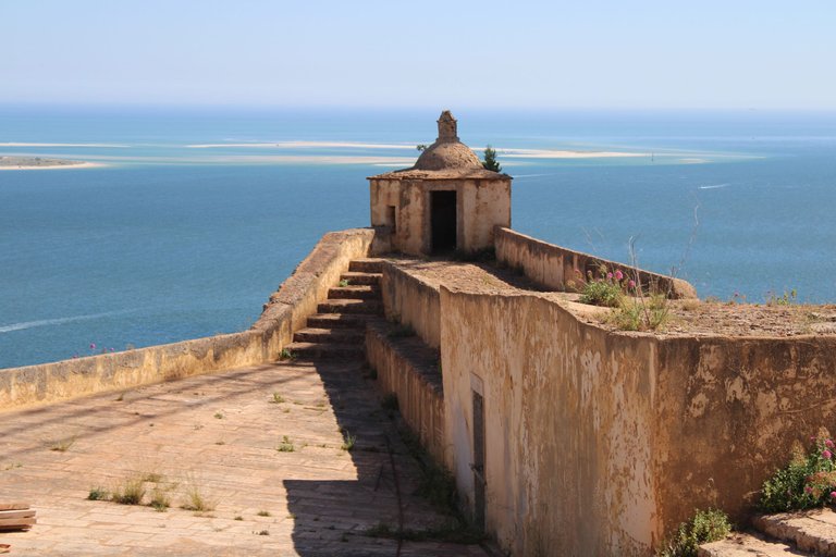
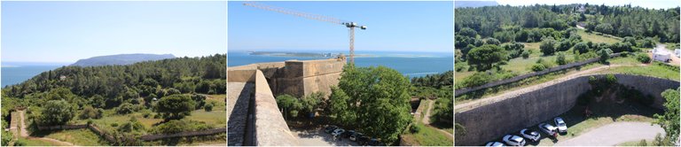
On the way to the military fort🌍🏔️/ Camino al fuerte militar🗺️📍
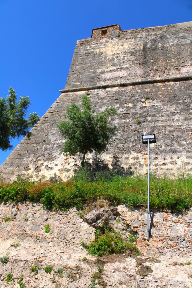
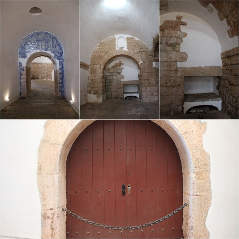
About the fort🌍🏔️/ Sobre el fuerte🗺️📍
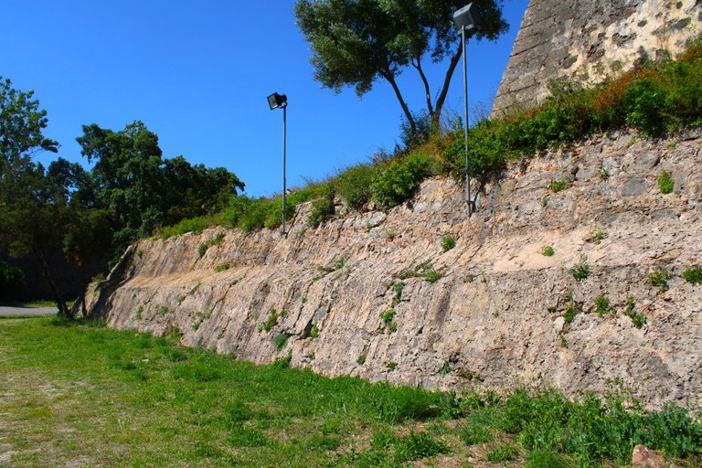
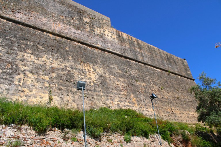

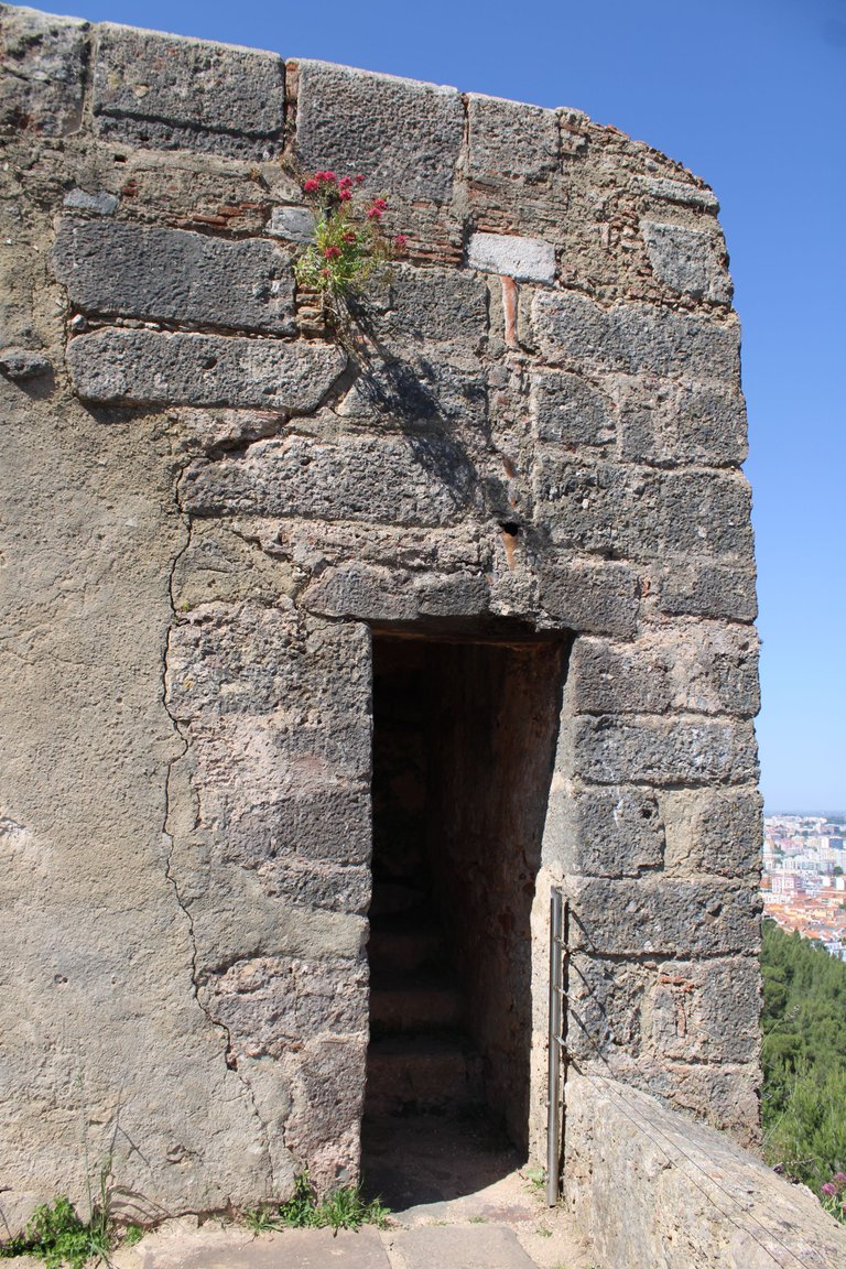
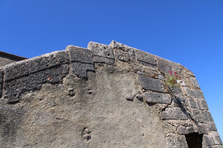
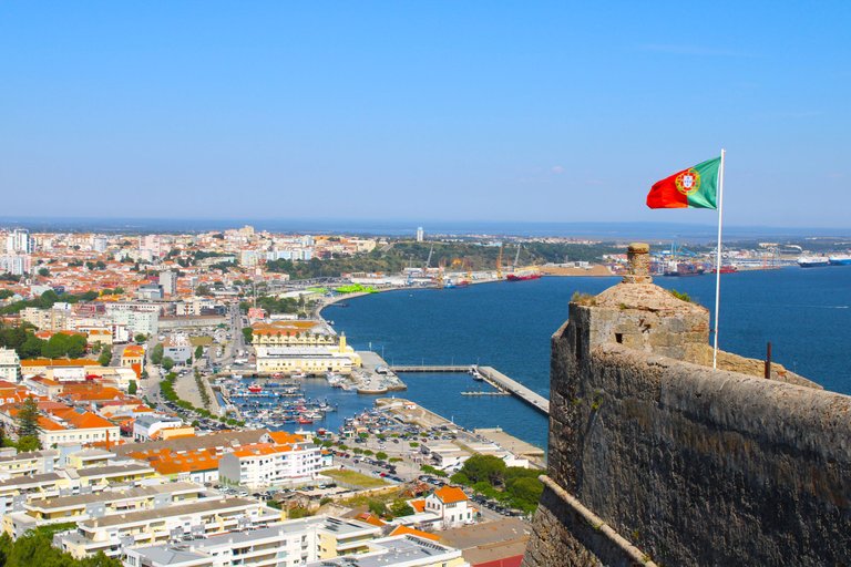
We've finally arrived, friends! We're almost at the end of this trail, and now we're going to admire and enjoy the São Filipe Lei fort, which was built under the rule of Louis I, who was of Spanish origin, meaning when Portugal was under the reign of Spain. This happened due to "arranged" marriages between crowns or the lack of a successor to the throne!🚩📍
¡Llegamos por fin amigos! ¡Casi terminando este sendero y ahora vamos a admirar y disfrutar el fuerte de São Filipe lei que fue construido bajo el mandato de Luis I que era de origen Español o sea cuando Portugal estaba bajo el reinado de España, esto sucedió por casamientos "arreglados" entre coronas o falta de sucesor al trono!🏰🏔️
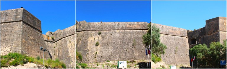

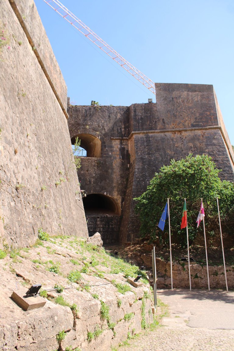
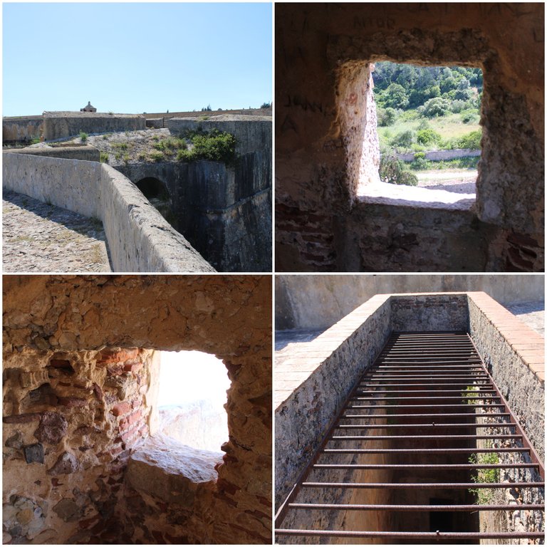
It was built between the years 1527-1598 and is currently classified as a national monument in the 90s. The architect who designed this modern war marvel of the time was Filipe Terzi. Let's say that for some reason the kings of Portugal grew tired of the pirates who came from Africa and France consecutively to rob the Setubal area and to avoid this, the forts were built, this one here and Outao.
Fue construido entre los años 1527-1598 actualmente es monumento nacional clasificado en los anos 90, el arquitecto que dio obra a esta maravilla moderna belica de la epoca fue Filipe Terzi, digamos que por alguna razon los reyes de Portugal se cansaron de los piratas que venían de África y Francia consecutivamente para robar la zona de setubal y para evitar esto se construyeron los fuertes, este de aquí y Outao.
https://www.mun-setubal.pt/forte-de-sao-filipe/
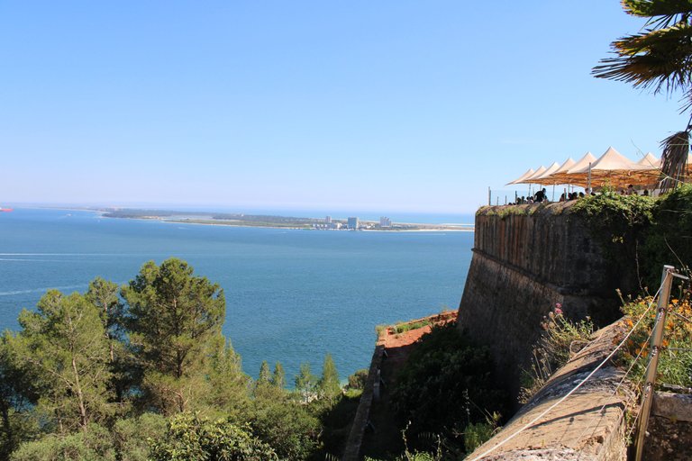
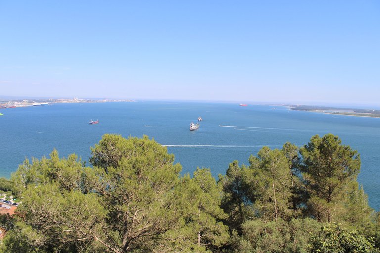
The cafeteria with the best view🌍🏔️/ La cafeteria con la mejor vista🗺️📍

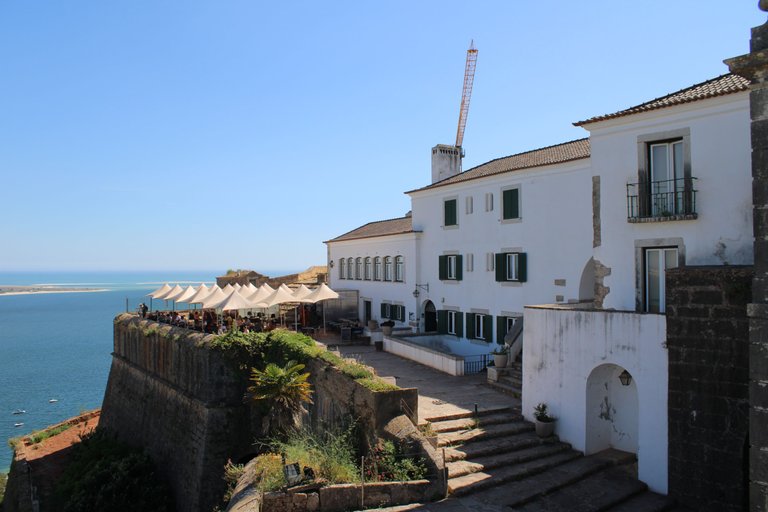
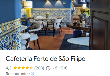
What do you think? Would you like to have a coffee here, 200 meters high, while enjoying a panoramic view of Setubal, the Troy Peninsula, and the majestic Atlantic Ocean? These are just some of the things you can do while you're here.🍣📍
¿Qué les parece? ¿Se tomarían un café aquí a 200 metros de altura mientras tienen un campo de visión de Setubal, la península de troya y el majestuoso océano Atlántico?, otras de las cosas que puedes hacer estando aqui.🧁🍪

THANKS FOR READING ME (PHOTOS AND VIDEOS OF MY PROPERTY) / GRACIAS POR LEERME FOTOS Y VIDEOS DE MI PROPIEDAD🙂🧠🦾👍
You can check out this post and your own profile on the map. Be part of the Worldmappin Community and join our Discord Channel to get in touch with other travelers, ask questions or just be updated on our latest features.
Good morning, dear friend @biologistbrito
What a beautiful place you're showing us on this occasion. I appreciate all the tips you give us for visiting this beauty.
The place you chose to take a break and hydrate was wonderful.
Beautiful photographs. Thank you so much for showing us another beauty there.
Have a great day.
thanks for the support
We appreciate your work and your publication has been hand selected by the geography curation team on behalf of the Amazing Nature AN Community. Keep up the good work!
Hiya, @lauramica here, just swinging by to let you know that this post made it into our Top 3 in Travel Digest #2575.
Your post has been manually curated by the @worldmappin team. If you like what we're doing, please drop by to check out all the rest of today's great posts and consider supporting other authors like yourself and us so we can keep the project going!
Become part of our travel community:
Que hermosos paisajes y espectaculares fotos 😍 esa temperatura estaba perfecta, hacer rutas largas con calor tal como dices no es para cualquiera, pero a quien le gusta estás cosas aguanta con gusto, hacer senderismo es ejercicio para el cuerpo y el alma 💞 gracias por compartirnos tu aventura. Saludoss y bendiciones 🙏
abrazos gracias por tus palabras
Thanks for sharing this @biologistbrito ! It didn't feel like we were following a military camp, because of the amazing greenery and scenery you showed us! I hope you had a blast on this trip, though!
:D thanks
Thanks for your contribution to the STEMsocial community. Feel free to join us on discord to get to know the rest of us!
Please consider delegating to the @stemsocial account (85% of the curation rewards are returned).
Consider setting @stemsocial as a beneficiary of this post's rewards if you would like to support the community and contribute to its mission of promoting science and education on Hive.
Wow! It’s a journey through time, nature, and resilience. The landscape is shifting from the stillness of the valley to the fresh Atlantic breeze in the mountains really paints a beautiful experience. The panoramic view of Sebutal and the Atlantic Ocean is absolutely breathtaking! A perfect moment to pause and appreciate nature’s beauty after the long trek.
Wow... what a great post......with very interesting pictures to look at. I hope you have a nice day my brother and continued success for you♥️
@biologistbrito Interesting publication👍
Congratulations @biologistbrito! You have completed the following achievement on the Hive blockchain And have been rewarded with New badge(s)
Your next target is to reach 12000 upvotes.
You can view your badges on your board and compare yourself to others in the Ranking
If you no longer want to receive notifications, reply to this comment with the word
STOPCheck out our last posts: